
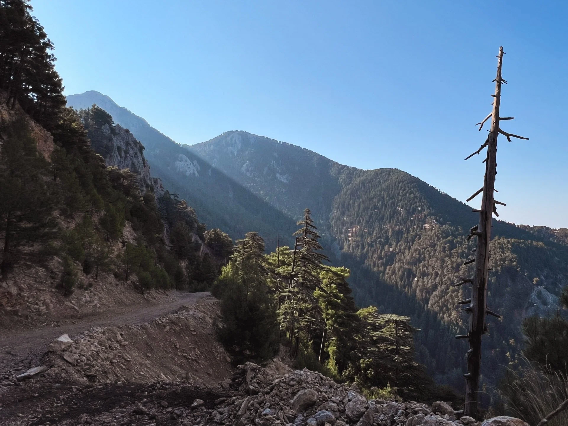
Photo taken on Barla - Dikmen Section of the hike - Isparta, Türkiye (more photos below)
St. Paul Trail
Southern Turkey, August - September, 2024
Notes & Photography
Basics
Route: St. Paul Trail ( Official Site )
Dates: August 28th, - September 8th 2024
Type: MultipleSection Hike (210 Km / 10 days)
The shortest version for thru-hiking is around 330 km's
Starting Point: I chose to skip the flat areas closer to the city of Antalya, consciously missing Perge and somewhat reluctantly skipping Pednelissos, further up. I started just north of Pednelissos and Pınargözü.
Getting There: Istanbul to Antalya (night bus) > Antalya Otogar to Serik Minibus (get off at Gebiz Junction) > Serik to Gebiz Minibus > Hitchhike to the St. Paul Trail intersection point shown on the map to the side. Return: Yalvaç to Istanbul (Night bus)
Resources
- A great introduction would be the cultural routes society website:
https://cultureroutesinturkey.com/st-paul-trail/
- Main resource for this route is the book written by the person who created it, Kate Clow:
https://www.trekkinginturkey.com/?product=the-st-paul-trail-2nd-edition
(Unfortunately, advertised mobile application is no longer available)
- I did benefit greatly from Amy and James’s trip reports, and the site in general (very inspirational)
https://doingmiles.com/2011-04-turkey-saint-paul/
- Also, I will try to find and share a map file here, which I found on the internet, it is in German and has some great information. The camping place I found in the canyon was thanks to this map. (Zeitplatz, Quelle… Danke!)
Introduction to St. Paul Trail
The St. Paul Trail is one of the longest trekking routes in Turkey, stretching across the provinces of Antalya and Isparta in Southern Türkiye. It is inspired by the first Anatolian trip of St. Paul (and Barnabas) and covers the parts between Perge and Pisidia Antiochia, with the city of Adada almost in the middle of the way. It starts at sea level, crosses the Tauruses, heads north and east, and ends in Yalvaç (a modern town next to Pisidia Antiochia) at an altitude of 1,100 metres. An alternative branch from Perge to Adada is from Aspendos to Adada. Aspendos is also an ancient city in Pamphylia, just like Perge.
Personal Notes
St. Paul’s first journey is roughly 1,979 years old. The St. Paul Trail is 20 years old. New quarries, new roads, receding water levels, and disappearing forest paths due to the decline of husbandry are some things that probably make this path look quite different compared to the early 2000s when it was conceived, but in the greater scheme of things, I think not much has changed since the 0000s.
On my rest day at the end of the trip in Yalvaç, I spent most of my time under an 800-year-old sycamore (çınar, Platanus orientalis) tree at the coffeehouses, facing the old Devlethan Cami.

Coffee well deserved - Yalvaç, Isparta
The book in the picture is by Mehmet Özhanlı, who leads the archaeological team at work in Pisidia Antiochia. I had the chance and pleasure to meet him and the team—special thanks to Mr. Samet. This book is a fictional work based on archaeological findings. I have not progressed deep into it, but so far I like the way it addresses religious continuity and borrowings in the setting of Antiochia Pisidia, through Anatolian (Men - Deity of Moon), Ancient Greek, Hellenistic/Roman, and later Christian belief systems. Here’s Prof. Mehmet Özhanlı’s website: https://mehmetozhanli.com and to the book (in Turkish).
The St. Paul Trail offers a very exciting, beautiful journey through an interesting geography of plains, mountains, plateaus, lakes, forests, canyons, valleys, barren mountains, and villages. It provides much to think about and actively meditate on as you hike, such as the beauty of nature and the pastoral setting. On the flipside, you’ll also witness lakes drying up and mountains being eaten by marble quarries, prompting thoughts on climate change and ecology.
St. Paul became a topic of interest for me as I prepared for this trip. The more I read about him, the more interesting he became, and reflections on belief, determination, sacrifice, and dedication—values that fueled his journeys—accompanied me along the way.
Perhaps it’s the combination of history and archaeology, together with the natural beauty of the Taurus Mountains and surrounding area, that makes this trail so appealing. Most of the time, you're far from any civilisation, encountering shepherds and no one else for long stretches. Speaking of history, you'll be surprised to find a note carved into the Yazılıkaya canyon by Epictetus, a famous Stoic and a freed slave. Given that Stoicism is enjoying a nice comeback in the age of Insta(nt)Gra(tification)m, this could be of interest to many. And for the record, the climb from the bottom of the canyon to the viewpoint at the top is the hardest part of the entire St. Paul Trail.
Feel free to get in touch with any specific questions, and I’ll try to answer.
Photography
Tools: Iphone & Lightroom.




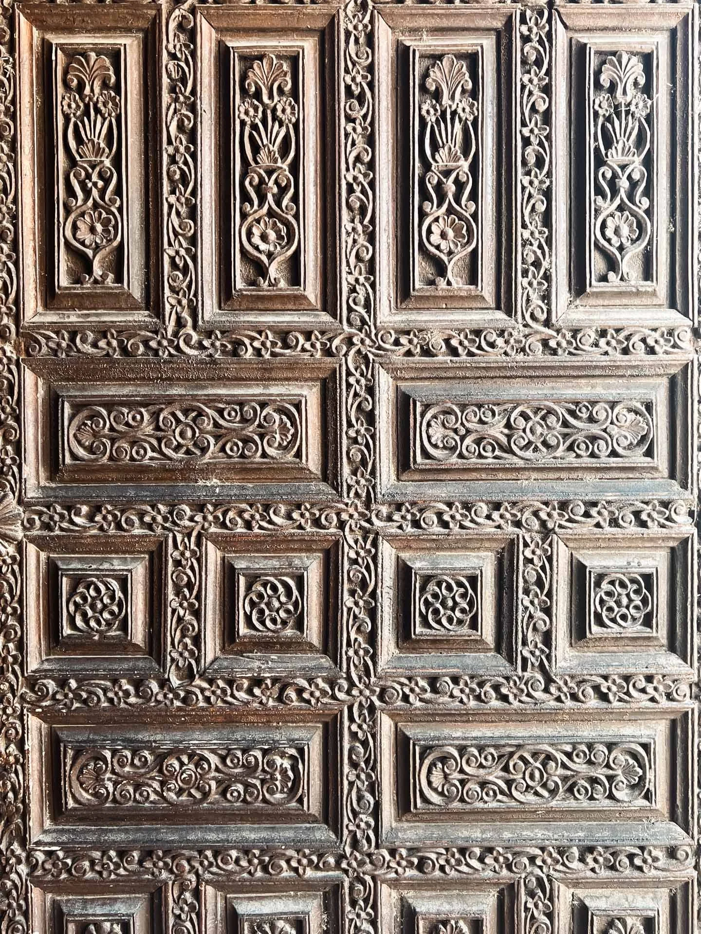


About Sections (I hiked)
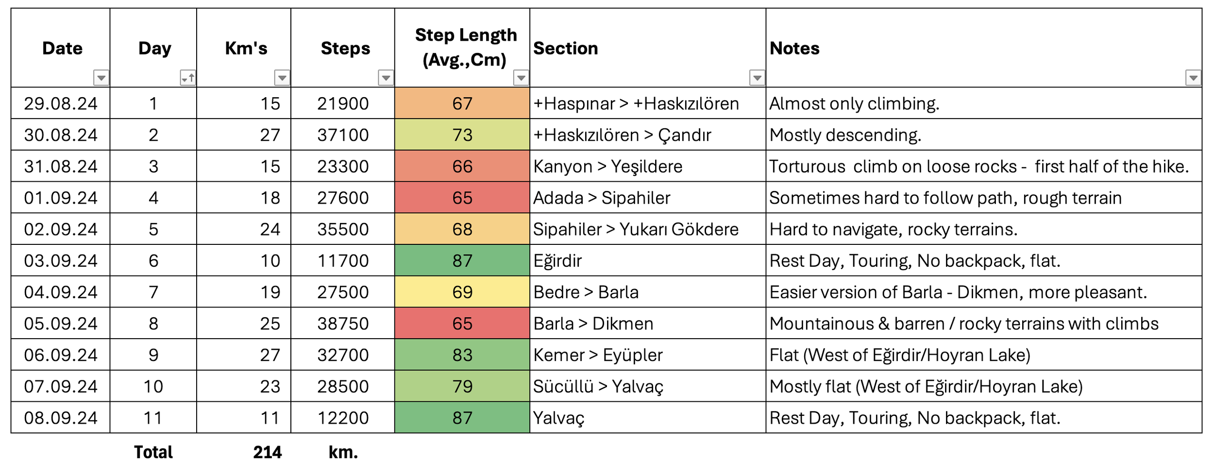
The distance presented by Caltopo on the map and the actual distance walked vary significantly. I am sharing the Excel file I created using data from the iPhone 13’s Health app—steps and kilometers. I then calculated the average step length per section, and it correlates exactly with the experienced difficulty of each section - step length decreases as difficulty increases. (For example, on days 6 and 11, most of my walking was spent exploring towns/ancient sites without my backpack, resulting in the greatest step lengths.) You can match this data with the Caltopo map link above. Also, if you see days 3 and 8, both including long altitude gains on very instable, loose ground, thus resulting as the hardest sections of the trail.
Challenges / Recommendations
I truly loved the St. Paul Trail, and I’m sharing the challenges below as a heads-up on what to expect and how to prepare accordingly. If you plan to explore it, you certainly should—I’m sure it will be well worth your time and effort.
The Ground: Certain sections with large, loose rocks really slow you down. Smaller, slippery rocks are also a challenge. (If I were to go again, I’d opt for trekking shoes/boots with heavier soles.)
Climbs & Descents: Nothing much to add here—working against gravity is part of the joy. That said, descents, especially with the ground conditions mentioned above, are no easier than the climbs.
Navigation: As one shepherd put it during our chat, "Forests are swallowing the paths that goats used to keep open." A significant portion of the St. Paul Trail passes through forests, and the paths have become indistinguishable, if not impassable. Additionally, it's been a long time since the trail was marked and published. There are now new roads—tarmac, gravel, and dirt—that either confuse or obscure the SPT signs. (There’s not much to be done here, but I’ll share my notes with the team overseeing these sections.)
Water: I may have trekked during the driest time of year for this region, but especially the stretch between Adada and Yalvaç, apart from the village fountains, was mostly dry. This makes camping less favorable and adds about 2 kg to your load due to the need to carry extra water.