
Somewhere between Dom Planika and Koca na Dolicu, Triglav National Park, Slovenia
Slovenia Mountain Trail (Section Hike)
Slovenia - August, 2025
Notes & Photography
Basics
Route: Slovenia Mountain Trail ( Official Site )
Dates: August 21st - 28th, 2025
Type: Multiple Section Hike (210 Km / 10 days)
Thru-hiking the whole trail is around 617 km.
Starting Point: Aljazev Dom, Near Mostjana ( Vrata Valley )
Getting There: Flight to Ljubljana 20th of August, one day in the city, early next morning bus to Mostjana Dovje - Shuttle bus to Mostjana - quick visit to Slovene Alpine Museum - Shuttle bus up to Aljazev Dom
Afterwards: Adriatic coastal chill for 3 days (to the best of my ability to chill) in Piran, Isola and Trieste. Shuttle from Trieste port back to Ljubljana airport (around 1,5 to 2 hours)
Resources
- I checked out a lot of blog posts and maps etc, but still the official site is the main source:
https://www.slovenska-planinska-pot.si/index_en.php
(The map can feel clunky to use, but it is the most accurate map you’ll get on this route)
- PZS membership:
Also, if you are planning to stay in the huts (you’ll have to, since no wild camping is allowed in Triglav, and you’ll want those hot meals in the huts) and you need some sort of insurance on the mountains, consider becoming a PZS member:
https://clanarina.pzs.si/?lang=2/
Map
Here is the map I used this year to prepare and to follow on the trail as offline navigation. To look at the sections in detail, follow the link under the map or here:
Introduction
Slovenia has been on my radar for a while, knowing that it is a country loved by outdoors people, offering huge diversity within a small surface area. After some research, I came across the SMT and still had the chance to plan for the recommended season: July & August. Established in 1953, the Slovenia Mountain Trail is the oldest marked long-distance trail in Europe, crossing the entire country from the alpine northeast to the Adriatic coast. I would have loved to the whole thing from Maribor to the coast but I am very satisfied with the parts I traversed.
About Sections (that I hiked)
At times strenuous, this trail is the first ever Alpine venture for me, so it will have a special place - as it already does. Every single day has been a completely different adventure, landscape, and feeling on this trail which is quite interesting. Here is a short summary and you can see the different days on the embedded map.
Day 0 - Ljubljana
In from Istanbul, going around the city, picking up some orders from European retailers.
Day 1 - Aljayev Dom > Triglavski dom na Kredarici
Long and strenous first day: Bus from Ljubljana to Mostjana Dovje - Shuttle to Mostjana - The museum - Shuttle up to Aljayev Dom. The trek starts here. This is a climb with 1500 meter elevation gain over 7 kilometers. It has scrambling, via ferrata, and very steep climb all through. Moreover, most of my climb was in rather heavy rain so it really exhausted me on day 1.
There are more than one ways to get on top coming from Vrata Valley. I took Cez Prag, the other one is called Tominskova Pot, and the Czech guy I met at the beginning of the trail and we walked around the first kilometer together took the Lujkna Pass to come to the same Dom about 1,5 hours later (that is a very long way to take)
Kredarici is a large hut, but it was quite empty, because of the rain. It was around 2 degrees up there. It was about 2 degrees celcius up there.
Day 2 - Triglavski dom na Kredarici > Koca na Dolicu
On the map it includes the climb to the Triglav summit, but I skipped it due to weather conditions and my own flu from the day before. The walk to Dolic goes by Planika Dom (stopped for hot chocolate) Later, I learned from Marjan in Dolic Hut that Planika means Edelweiss, as shown in the picture below top right.
This was not an easy hike but with amazing photo opportunities of mountains. I got to Dolic hut rather early and rested.
Day 3 - Koca na Dolicu > Koca pod Bogatinom
This route goes through the seven lakes valley, beautiful hike, first 5-6 kilometers pretty much on rock without any vegetation, and then with some slow descent to the valley. It kept raining that day too, weather change was rather swift. By the time I got to Jezerih Hut right on the way, sun came up, I got dried, ate lunch, got a aspirin, drank warm tea, dried my stuff - it was the most rejuvenating break ever. The rest of the way from Jezerih to Bogatinom is through a beautiful forest.
Day 4 - Koca pod Bogatinom > Dom Zorka Jelincica na Crni prsti
The crowd in Bogatinom is different compared to earlier huts since this one is reachable from Lake Bohinc area and it sits beautifully in an opening in a forest, so it felt more like a holiday cabin than a mountain hut, still lovely experience.
This day was the longest walk on this trip, around 22 kilometers and with a lot of ascent and descents. While planning at the comfort of my home, apparently I got myself walking up a ski slope. Not recommendable. Please mark an alternative way if you are taking mine as a base.
The second half of this trail is amazing, it is practically having you walking on a ridge, crossing the slopes. Also, At one point one can see Triglav and the Adriatic sea from the same place.
Day 5 - Dom Zorka Jelincica na Crni prsti > Planinski dom na Poreznu
This is easily my favorite hut. When I was approaching past sunset actually I could see it above the clouds. It is a smaller hut, isolated, sits on the Crn Prst peak and people who run it are lovely.
The destination of this day’s trail is visible from the beginning, Dom na Poreznu sits on the next mountain top, and you can see it while you are starting your walk. It is a big descent - passing through a small village / roadside and ascent again.
Day 6 - Planinski dom na Poreznu > Cerkno (Town Center) — Bus Connection to Idrija — Stay in Idrija
Dom na Poreznu was also beautiful stay but I was alone in that huge hut (it seems to be one of the largest ones) The hike is a beautiful green descent with animals around. When one walks all the way down to civilization, the village roads are surrounded with fruit trees. In the final part a gentle descent down to Cerkno (I headed directly to the museum - quite a good one actually) and then took the bus to Idrija.
Idrija is a very orderly town. It has been the largest Mercury mine in Europe until the late 90’s when it was permanently shut down for health reasons. I stayed in Gostice Barbara, which is on the same building with the mine (now serves as a touristic attraction - worth to do). Beautiful stay, nice town.
Day 7 - Idrija — Bus Connection to Col / Pod Kraj — Pod Kraj > Koca na Nanosu > Mirjam Camping (Razdrto)
There is no direct bus connection to Pod Kraj - So I took the bust to Col and hitchhiked to 3 villages down. The walk to Koca na Nanosu is through the forest but maybe half of it has been on the road - though cars pass by very seldomly. This is not a bad thing, but after Triglav it took me a while to adapt. I had lunch at Koca na Nanosu, a good looking hut by a TV transmission station on the top of Nanos. The walk down is quite steep and actually takes quite a while. (Later going back to Ljubljana from Trieste I passed from this point again on the highway)
I had a drink at Mirjam camping and found out the connection busses to the shore (Koper in this case) It seemed like a enjoyable place to stay yet I needed to move on. (Had a lovely chat with the manager on rock music and bass guitarists.)
Piran, Izola and Trieste
So remaining few days were spent in Piran, Izola and Trieste - Beautiful Adriatic towns. I’m including photos from these locations too. The two cultural highlights were 1) Tartini days in Piran - I attended to one free and one paid concert, both good, but the second one with Austrian Baroque Company was really amazing - led by a flautist. Bass guitar is good, but that bassoon sounded so clear and to the point and musical in that Franciscan Chapel. Interestingly I saw the marking on the floor that that chapel might be a donation by the Tartini family.
Second highlight was Revoltello museum in Trieste. I haven’t seen such an appealing collection of beautiful sculptures and classical (19th and early 20th century) paitings in a while. I think all artists there are from Italy and maybe from the region, it does not feel limited at all.
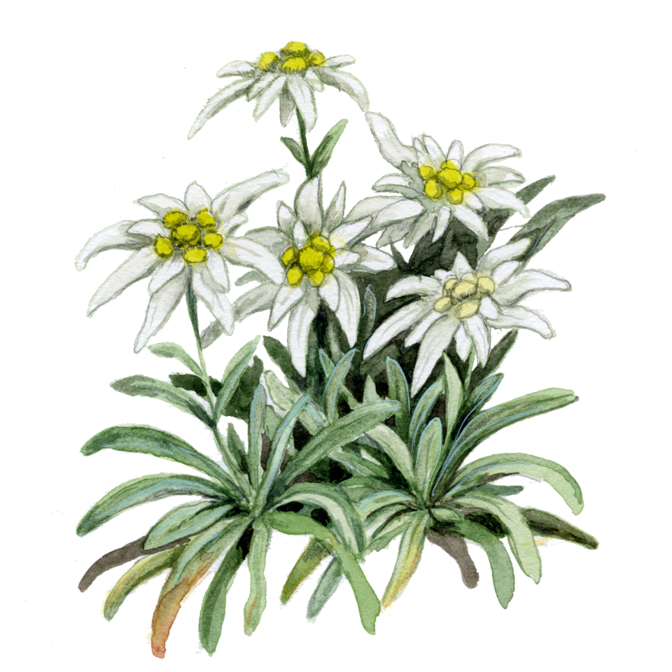

Edelweiss / Planika / Stella Alpina / Etoile des Alpes (French and Italian are the same - “Star of the Alps” and apparently German name means “Noble White”.
Srecno! — the traditional miner’s greeting in Idrija, meaning Good luck or Stay safe. I understand has a strong solidarity tone to it.
I took this picture at the entrance to “Antonijev rov” now serving as the museum and tour for the Mercury mines of Idrija.

From “Naturae. Contemporary Art environments” just at the entrance of Miramare Castle. A good reminder.
Challenges / Recommendations
Water: From the huts I’ve seen, only Jezerih has a source for drinkable water. The rest use rain water collection and the advise against even filtering it to drink it. On the trail, I had no water sources most of the time, so it is a good idea to have around 2 liter capacity to carry. In the huts, 1,5 liters of water cost 6 Euros. (The are brought by helicopters)
The Ground: Alpine ground, mostly rocky, not easy at all. Puts a lot of strain on feet and ankles. Some people do wear lightweight trail running style shoes, they do have advantages - especially downhill - but I’d still recommend sturdy boots.
Navigation: This route is very well marked on both directions. I had not once felt like I lost the trail. Also, the signs keep showing the distances to the peaks and huts around at the intersections. So, from a navigation point of view it is perfect. I did have offline maps available on my mobile.
The weather / Clothing: The weather is changing very quickly. Gore-tex shoes and top a must- I used also overpants for in rain.
Slovenia: Almost everyone speaks English, very straightforward communication, Slovenes are very friendly people and it is a very pleasant country to travel in.
As always, feel free to get in touch with me with your questions.
Photography
I grouped photos into two seperate albums; first group is for the photos from the trail.


