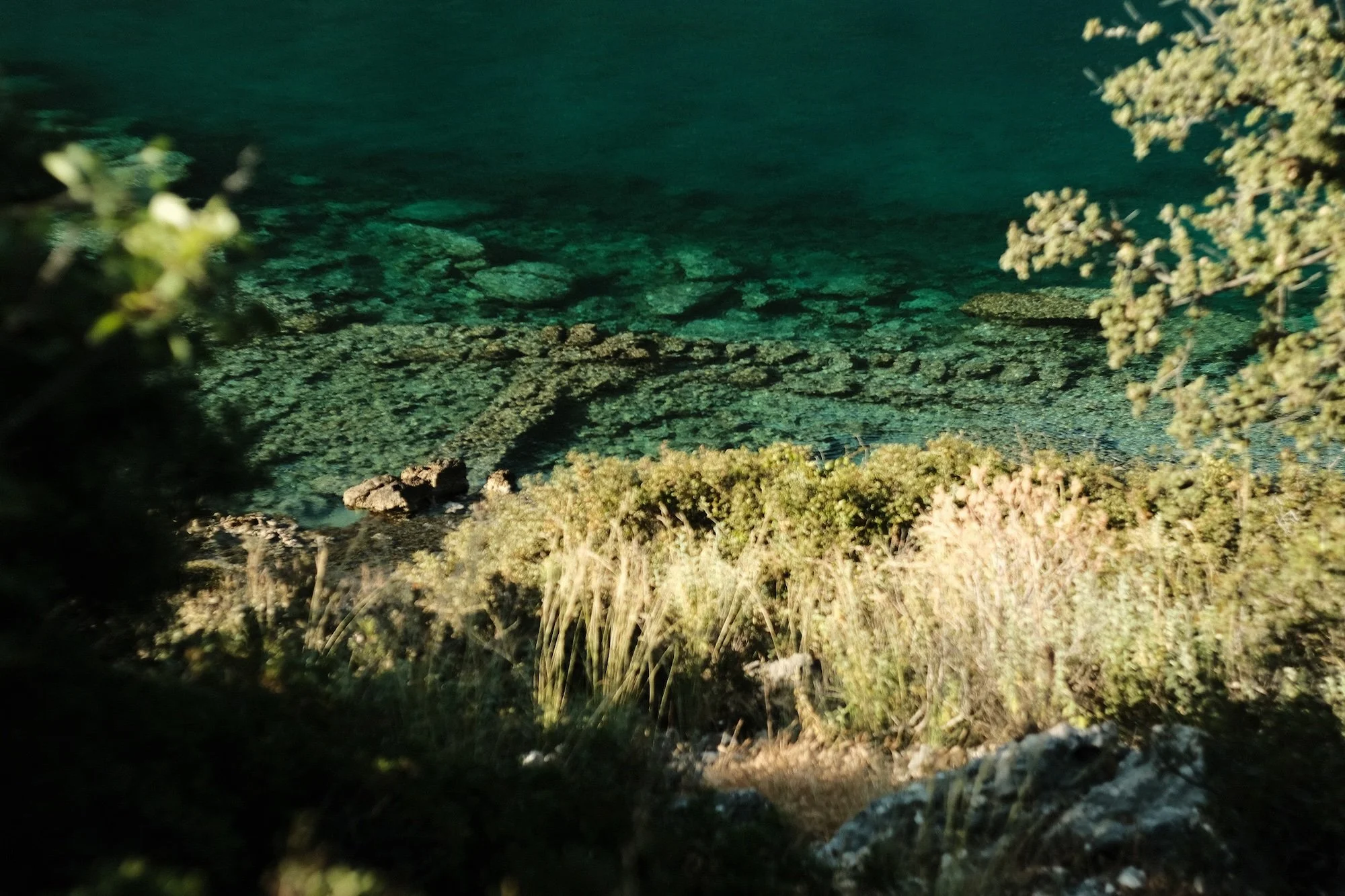
Sunken port of Aperlai, Lycian Way, Antalya (more photos below)
Lycian Way
(Kaş - Demre Section Hike)
Route Notes
Antalya, Southern Turkey, May 2026
Basics
Route: Lycian Way ( Official Site )
Dates: May 25 - 29, 2026 (Additional days in Kaş, Meis, Patara & Antalya)
Type: Section Hike (Kaş to Demre / 55 Km / 4 days)
This is a very popular section of the Lycian Way - actually geographically it is at the very center of it too - mostly because it goes almost next to the sea for a considerable portion of the section, presenting great opportunities to camp right next to the sea and swim, as well as dense archeological remains.
Starting Point: Kaş - town centre.
Getting There: Istanbul (SAW) to Dalaman flight (1h 10m.) Dalaman Airport to Kaş shuttle (private, very fast, 2 hr 20 min)
Return: Bus (Batı Antalya is the only company in the region) to Antalya available from Patara / Kaş / Demre. Antalya to Istanbul (SAW) flight (1h. 20 m.)
Resources
- A great introduction would be the cultural routes society website:
https://cultureroutesinturkey.com/the-lycian-way/
- Main resource for this route is the book written by the person who created it, Kate Clow:
https://www.trekkinginturkey.com/?product=once-upon-a-wallflower
- Wikipedia for general information:
https://en.wikipedia.org/wiki/Lycian_Way
- Trekopedia - This site has the most detailed descriptions for the Lycian Way stages. Full of useful information. It seems like they started their project with Lycian Way:
https://trekopedia.com/trail-lycian-way-1/
- Lycian Monuments - A fantastic resource about Lycian civilization and archeology. It features the translations of all major incriptions found on archeological remains in the region.
https://www.lycianmonuments.com/
Introduction to Lycian Way
The Lycian Way is Turkey’s first long-distance walking route, researched and waymarked by Kate Clow in 1999. It starts near Ölüdeniz and continues east toward Antalya, following the coastal part of the Teke Peninsula through old footpaths, mule tracks, Roman roads, villages, ruins, mountains, and sea.
It is now the most popular long-distance trail in Turkey, and it is also well recognized internationally. When I walked the St. Paul Trail in 2024, I covered around 220 kilometers without meeting another long-distance walker. On the Lycian Way, by contrast, even on a much shorter section, I met trekkers from several countries — some walking independently, others with guides.
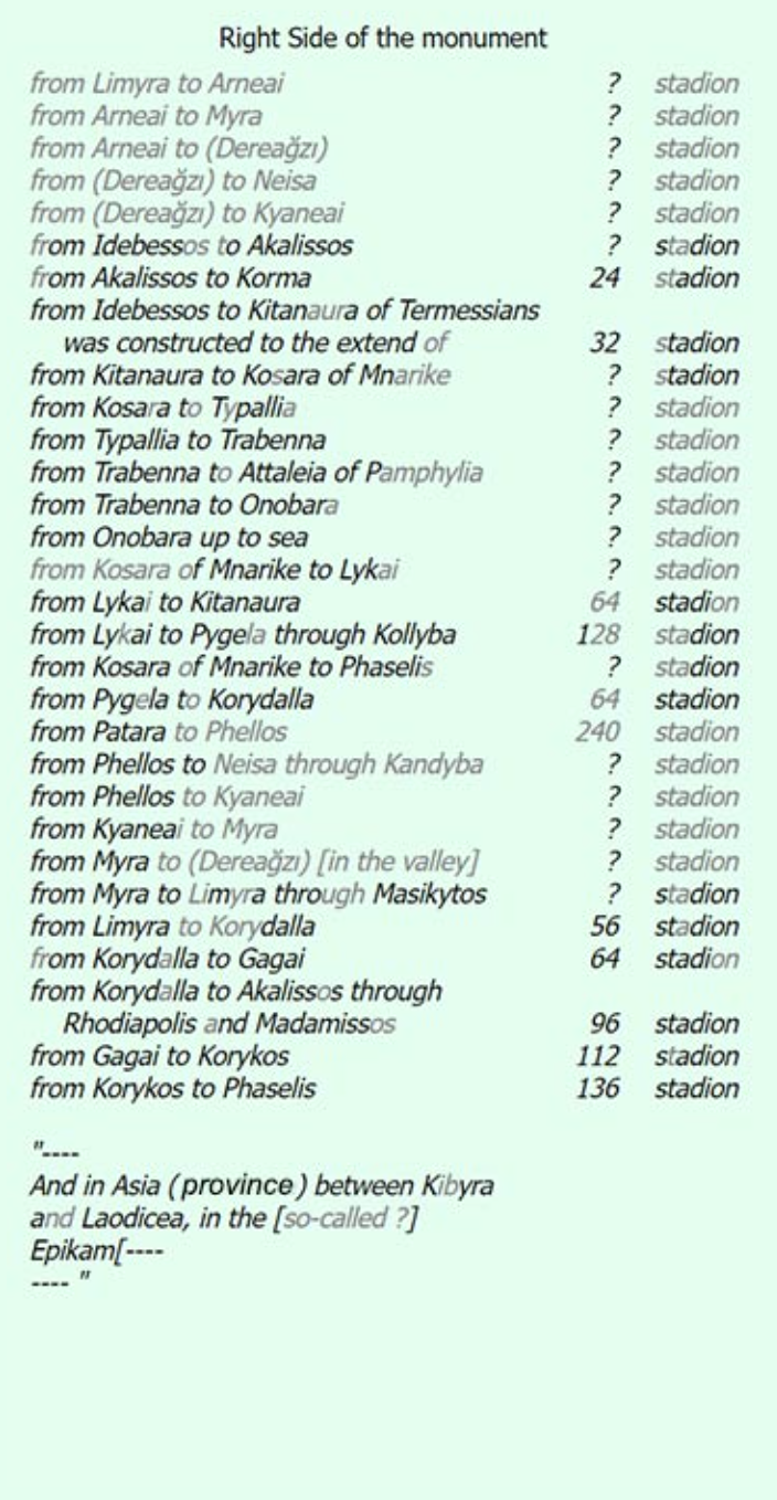
Regarding the origins of the Lycian Way, I remember talking with a professor of Archeology about the findings in Patara, specifically Patara Road Monument (Stadiasmus Patarensis) not as the origin maybe, but a historical context showing the connections of all (and beyond Lycian) settlements. (1 stadion is roughly 185 meters, although it is known to vary across the empire).
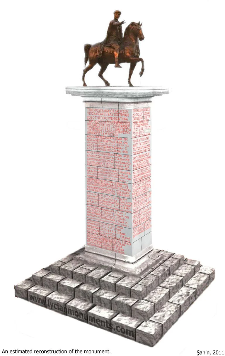

The image of the digitally reconstructed Patara Road Monument.
All three images are taken from the Lycian Monuments website I mentioned in the resources above. This is the exact url of Patara page - highly recommended: https://www.lycianmonuments.com/patara/
Map & The Daily Sections
Original map is here.
Personally, this walk was different mostly because I did slow down and did not focus on the distance to be covered per day. The region really provides excellent places to swim, snorkel, rest, meditate, read and so on. A second differentiator may be that all 4 nights of wild camping were right by the sea - which you will see in the pictures.
Day 1: Kaş to İnönü Cove
Day 2: İnönü Bay to Aperlai
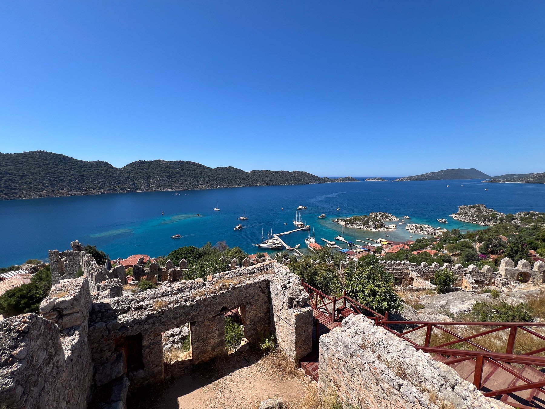
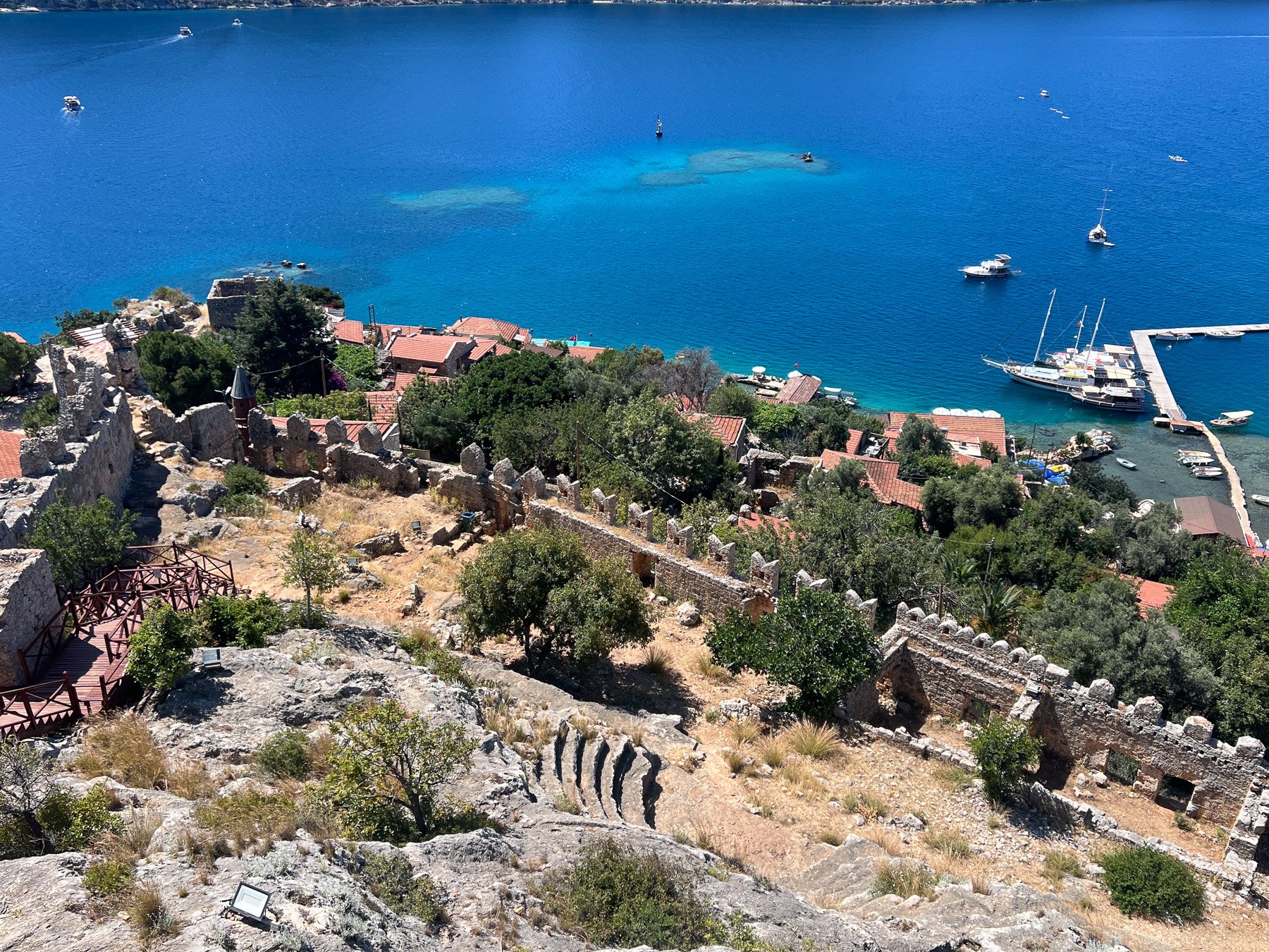
Day 3: Aperlai to Simena
Day 4: Simena to Çakıllı Cove
Day 5: Çakıllı Cove to Demre Çayağzı (Adriake)
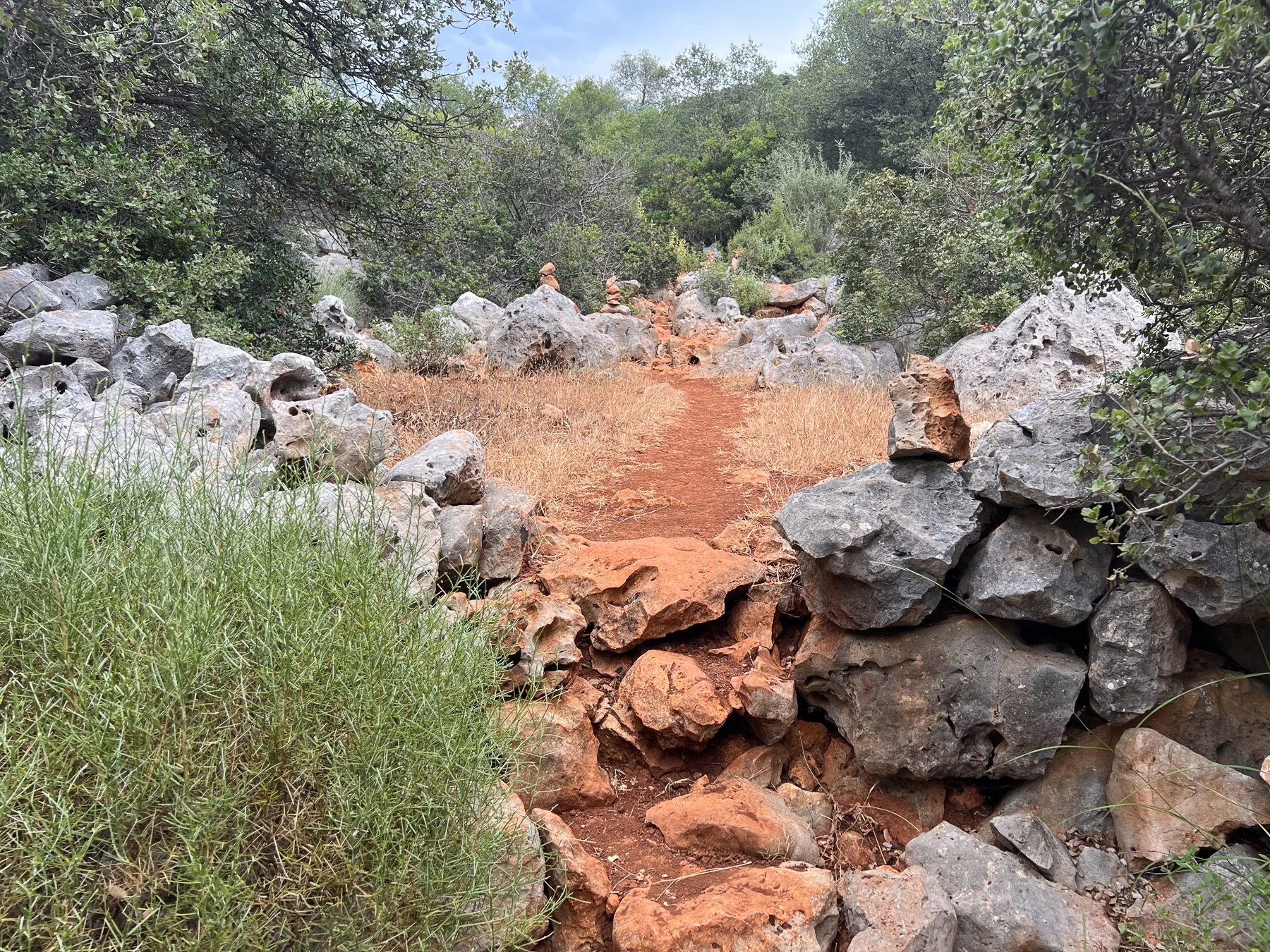
This is a pleasant day effort with beautiful land and seascapes. I think this day can be kept shorter by staying in Üzüm İskelesi (camping by the seaside or going up to the village) or pushed a bit further to climb up to Boğazcık village to stay in the local pensions. What I did was to go for İnönü Bay which I saw on the map which is a bit off the Lycian Way (maybe it was included before because there are some markings on stones) . It turned out to be a good gamble; however, there is no walking path down to the cove - I had to rock climb my way down and up (different routes) . I am not recommending it to anyone because it is not trekking but really scrambling and rock climbing to get there - Check out the pictures, and see it you’d like to go there at your own risk. It is obviously accessed by boat and I found an existing campfire set up. What makes it interesting is the fact that it is located where a creek meets the sea.


Starts with a nice climb to Boğazcık village - it is not steep or difficult, but in this section of Lycian Way, it might be the most steep part. A quick stop at Boğazcık village (water by the mosque). There is an alternative path to Sahil Kılınçlı inland if one wants to visit the Apollonia ruins (which you will see walking towards Aperlai in the hills afar). Then it is mostly a descent down to Aperlai.
Aperlai may take a few hours to really get to like it, but it was my favorite stop on this section. Do these: -Visit purple house - get something to drink, cool off (I had my dinner and breakfast there even though I was camping by the sea) - Get into the water, swim across, look at the archeological ruins from the other side. - Snorkel: What is forbidden in Kekova is permissible in Aperlai, as it is priceless to snorkel above the sunken port of the city. - Moon over the bay by night: That is unphotographable, (I tried) and it is not less than Greek (literally) if you chet my drift.


For those who do not know: Üçağız is a small village that does not really offer swimming spots, because it is mostly a closed body of water, and no one prefers to swim there when some of the most beautiful shores of the Mediterranean are just outside that bay. It mostly serves as a logistical stop for boat and kayak tours, which I also joined, unfortunately on a very windy day.
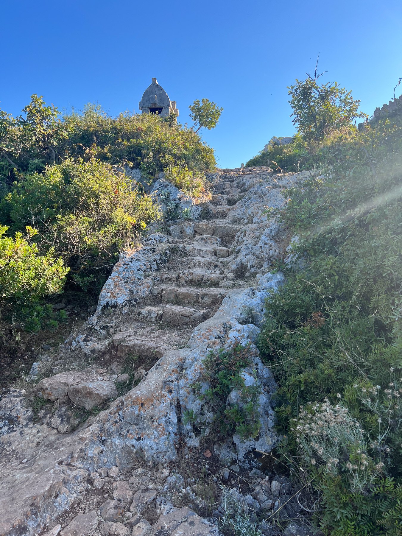
The walk from Kale Üçağız to Simena / Kaleköy is about 30 minutes. Most of the way is paved and therefore not very interesting. Then you arrive at the car park and climb on an old Roman street on foot. Simena is a car-free touristic village. It is not really a village by the sea; it feels like a tiny Mardin dropped onto the Lycian coast.
Something I learned during the kayak tour: Kekova was an important stop on the way from Europe to Jerusalem during pilgrimage routes, serving as the last mainland stop before Cyprus and the Middle Eastern mainland. Almost all pilgrims were members of certain churches, and these churches had branches in Kekova and the surrounding region. The payments, almost like travellers’ cheques, would buy the seafarers accommodation and food in these lands.


There are some Savannah like passages which I really liked in this route. It also passes by Istiada - one of main lycian towns in the region. After a few hours of rather pleasant, enjoyable walk, one arrives to Kapaklı, a village where they also offer accommodation and tent places. I made a stop for an early dinner there, then proceeded down to Kapaklı’s own cove where the water is quite cold because of streams flowing underground into the sea. I could stay there as well, but left for Çakıllı cove after a good swim. The walk from there to Çakıllı is also pretty straightforward. Çakıllı is a beautiful beach of fist-sized white pebbles overlooking at Çayağzı. Also the camping here was very very beautiful.


Çakıllı to Çayağzı was a relaxed, easy morning walk with beatiful scenery.
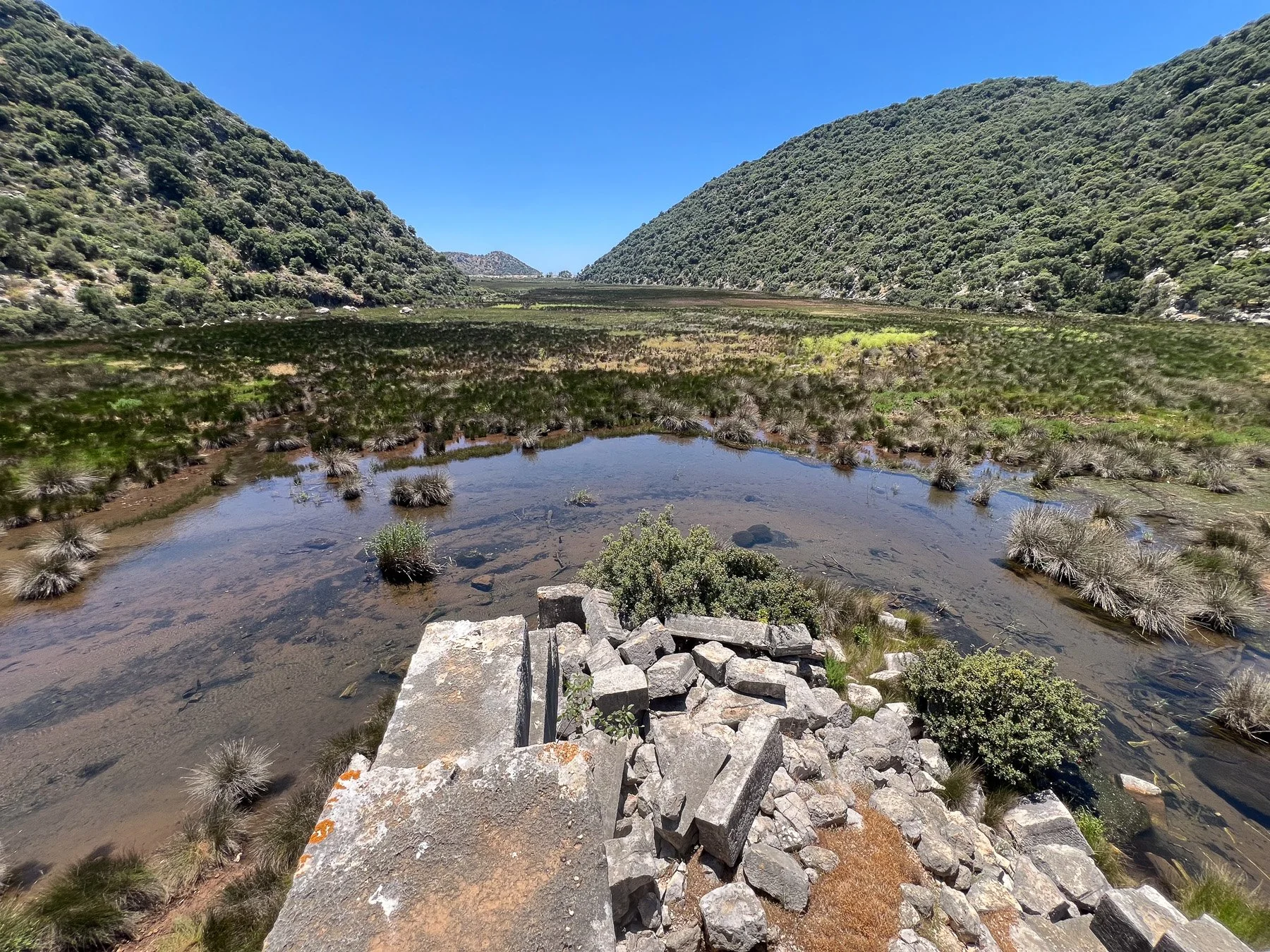
When you arrive to the sandy beach of Çayağzı you will cross a stream by a bridge. There is a guy - Salih Abi - from whom you can rent a kayak and go upstream among the reeds. This is a great experience, and your chance of seeing a sea turtle and mistaking it for a Caretta Caretta is 100% (photos below) I did first walk the beach to Çayağzı, had a breakfast at Adriake Camping and then changed and went back for the Lycian apocalypse then.
My goal was always to finish in Demre, but I was very upset by the fact that Lycian Civilizations Museum as well as Adriake Archeological Ruins site were both closed due to renovation. I visited Myra (which is definitely worth a visit) and St. Nicolas church in a previous visit, so I decided to go see Patara in the extra time I had.


Challenges / Recommendations
I don’t think I can talk about any real challenges after walking only a 60 km section of the Lycian Way. It is quite well-marked, straightforward, mostly flat, and a very enjoyable walk that is suitable for most levels. Moreover, you do not need to carry camping gear, since there are places to stay along the way that are conveniently located on the trail or right off it.
I would say drinking water is the only obvious challenge, and it forces you to pack less and make space for additional water.
My recommendation would be to slow down and enjoy the sea.
Other Stops / Activities Around
I also took the chance to visit Patara, which I highly recommend if you are not already walking that section of the Lycian Way.
Sea kayaking is one additional activity to consider around Kekova. Because Kekova Island is an archaeologically protected zone, visitors are not allowed to snorkel or swim around the island. You also cannot simply rent a kayak and go there by yourself; it has to be with an accredited company. Most of them operate out of Kaş. It is a half-day activity, usually from around 7 AM to 3 PM if you start and finish in Kaş, including the transfer, and lunch is usually part of the organization.